top of page
 |
|---|
The Tongariro Crossing Trek will take you from alpine meadow to mountain summit with stunning volcanic features along the way.
You will walk across a lunar landscape of craters, scattered pumice, active volcanoes, mountain springs, lava flows, emerald lakes, piles of scoria and statue-like mounds of volcanic rock - all testament to the forces that were unleashed to create this volcanic desert.
Mangatepopo to Soda Spring

Grade: Easy - allow one - one and a half hours
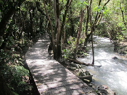
Adventure Lodge will drop you off at the Mangatepopo car park and the first section you cover is fairly flat, the track is well formed and board walked in damper parts, poles mark the way. About 15 minutes from the car park the track branches off to the right to Whakapapa.
Five minutes after this junction a side track leads left to the Mangatepopo Hut, and toilet facilities. The main track continues up the valley following the Mangatepopo stream and around the edge of old lava flows.
You will notice the change in plants as you climb in altitude; the last toilet stop is at Soda Springs until you get to the Ketetahi Hut.

Soda springs to South Crater
Grade: Moderate - Difficult allow 40 minutes to an hour
This section is steep - climbing from 1400 up to 1600 metres above sea level (known as the devils staircase) take your time and on a clear day the view down the valley and out across the surrounding countryside is well worth it! You may even see Mt Taranaki, another volcano on the western horizon.
Take care as you are walking over layers of ancient and modern lava flows and other volcanic debits so the track surface is not smooth. The track veers slightly to the left 5 minutes before reaching South Crater. To continue on the Crossing follow the marked route.
If Mt Ngauruhoe is clear and you have a beautiful day with plenty of time, you can make the decision to climb to the summit. Head for the old lava flow as it is very difficult if you try to climb up the scree.
South Crater to Red Crater

Grade: Moderate - Difficult allow 1 hour
It is great to be on the flat, but once you have crossed South Crater there is another short climb on an exposed ridge. The track follows the ridge to Red Crater. If you have plenty of time you can make the decision to summit Tongariro, just before reaching the crater, the route heads off to the left. The main track continues around Red Crater.
You have spectacular views over the Oturere Valley, Rangipo Desert, Kaimanawa Ranges and down to the emerald lakes, but it can be a little scary on a windy day.

Red Crater to Blue Lake
Grade: Moderate 30 minutes
To the left you will see an old lava flow from Red Crater spreading out across the floor of central crater. When descenting to the emerald lakes from Red Crater please take care as the loose scoria can move under foot. To the right are the Emerald Lakes, a great place to stop for your lunch.
The colour is caused by the minerals leaching from the surrounding rock. The steam vents above the lake are responsible for the sulphurous smell. You will notice the Track to Otureree Hut, part of the Tongariro Northern Circuit branches off just past the lowest lake.
The Tongariro Crossing track follows around the edge of Central Crater then climbs up to Blue Lake (a cold acidic lake) The lake is tapu (sacred) and it is disrespectful to eat or drink around its shores.
Blue Lake to Ketetahi Hut

Grade: Moderate 30 minutes - one hour
A short easy climb to the edge of North Crater, this was once filled with molten lava and then cooled and solidified to give an level surface more than 1000m wide. You have a sensational change in your outlook, in good weather there are spectacular views out over Mt Pihanga and Lake Rotoaira to Lake Taupo.
You then zigzag your way down to the Ketetahi Hut, the ground can be quite boggy and the pumice base is easily eroded - please stay on the main track.

Ketetahi Hut to Ketetahi Car Park
Grade: Moderate - two hours
The track crosses the stream that flows down from Ketetahi Springs, the rocks are stained by minerals in the water. Visitors are asked not to leave the track, as the springs are on private land.
You will need to follow the poled route down through the open tussock land to the clearing with some seats. At this point the track drops steeply to the Mangatetipua Stream.
A short side track leads down to a waterfall a few minutes before reaching the car park for your ride back to Adventure Lodge for a cold drink, and a hot spa.
You will need...
As the weather conditions can change rapidly in the region you need to be prepared with:
-
Tramping Boots (or good strong footwear)
-
Day pack
-
Wool jumper or fleece
-
Waterproof coat
-
Hat and gloves
-
First aid kit
-
Sun block
-
Food & water (at least 2L of water is recommended, any water found on the mountain is not safe to drink)
Download Tongariro Maps:
bottom of page
